City of Pittsburgh – Terra Firma
Pittsburgh is the second-largest city in Pennsylvania and the county seat of Allegheny County. Situated at the confluence of the Allegheny, Monongahela, and Ohio Rivers, it is known as the “City of Bridges” and historically the center of America’s steel industry. Today it is a hub of medicine, education, technology, and culture.
- Population: ~303,600 (2023)
- Incorporated: 1816 (as a city)
- Nickname: The Steel City, City of Bridges
- Official Website: pittsburghpa.gov
Neighborhoods of the City
The City of Pittsburgh is composed of 90 official neighborhoods, grouped informally into five vernacular regions: North Side + Downtown, East End, Oakland and Squirrel Hill, South Side, and West End.
These regions are not recognized by city ordinance but are universally used in planning, journalism, and local speech.
Neighborhoods of the City – Terra Firma
1. North Side + Downtown
This is Pittsburgh’s civic and symbolic core: the skyline, the Golden Triangle, the riverfronts, the stadium district, and the historic North Side neighborhoods just across the water. Downtown concentrates finance, government, offices, theaters, transit, and major public spaces. The North Side adds museums, sports venues, historic residential districts, and some of the city’s strongest connections to old Allegheny City. Together, they form the most “public-facing” part of Pittsburgh — the place of landmarks, events, institutions, and postcard views. Commonly associated neighborhoods include Downtown, the Cultural District, the North Shore, Mexican War Streets, Deutschtown, Troy Hill, and nearby North Side neighborhoods.
2. East End
The East End is one of the city’s most active mixed-use urban zones: walkable, neighborhood-driven, and full of restaurants, shops, bars, older main streets, and rowhouse-to-mansion residential fabric. It is less centered on one single institution than Oakland, and more defined by a chain of distinct but closely linked neighborhoods, each with its own identity. In common usage, the East End often brings together places such as Shadyside, East Liberty, Lawrenceville, Bloomfield, Garfield, Friendship, Highland Park, Point Breeze, Regent Square, and nearby districts. It is one of the clearest examples of Pittsburgh’s “city of neighborhoods” character — dense, varied, social, and highly local from block to block.
3. Oakland and Squirrel Hill
Oakland and Squirrel Hill are often grouped together because they sit side by side and combine two of Pittsburgh’s strongest identities: institutional intensity and stable neighborhood life. Oakland is the city’s academic, medical, and cultural center, anchored by major universities, hospitals, museums, and grand civic architecture. Squirrel Hill is more residential and family-oriented, but still highly urban, with strong commercial corridors, notable diversity, and immediate access to major parks. Together they represent a Pittsburgh that is educated, international, park-connected, and structurally central to the city’s daily life. Commonly associated places include North, Central, South, and West Oakland, plus Squirrel Hill North and Squirrel Hill South.
4. South Side
The South Side is one of Pittsburgh’s clearest topographic identities because it is split between the river plain and the hillside above it. The South Side Flats are the busy commercial and nightlife spine, especially along East Carson Street, with historic industrial-era fabric, retail, restaurants, music venues, and bars. The South Side Slopes climb sharply upward into steeper, quieter residential terrain marked by stair streets, hillside churches, and commanding views. In broader popular speech, this southern urban belt is often mentally linked with nearby river-and-hill neighborhoods such as Mount Washington and Duquesne Heights, even though those are distinct official neighborhoods. The South Side region, then, feels like a meeting point of industry, entertainment, steep terrain, and classic Pittsburgh riverfront urbanism.
5. West End
The West End is the loosest and most informal of the five labels. Strictly speaking, West End is a very small official neighborhood, but in common use people often stretch the name to cover a wider cluster of western neighborhoods and nearby communities on that side of the city. What unifies the area is less a single commercial core than a shared geographic position west of Downtown and a reputation for being more residential, more tucked away, and less visited by outsiders than the East End or core city districts. It includes a mix of hillside neighborhoods, overlooks, older working-class districts, and connector corridors leading toward the airport side of the metro. In casual use, “West End” may refer not only to the official West End neighborhood but also to places like Elliott, Sheraden, Westwood, Crafton Heights, and adjacent westward districts
Pittsburgh Albums
Pittsburgh Through the Maps
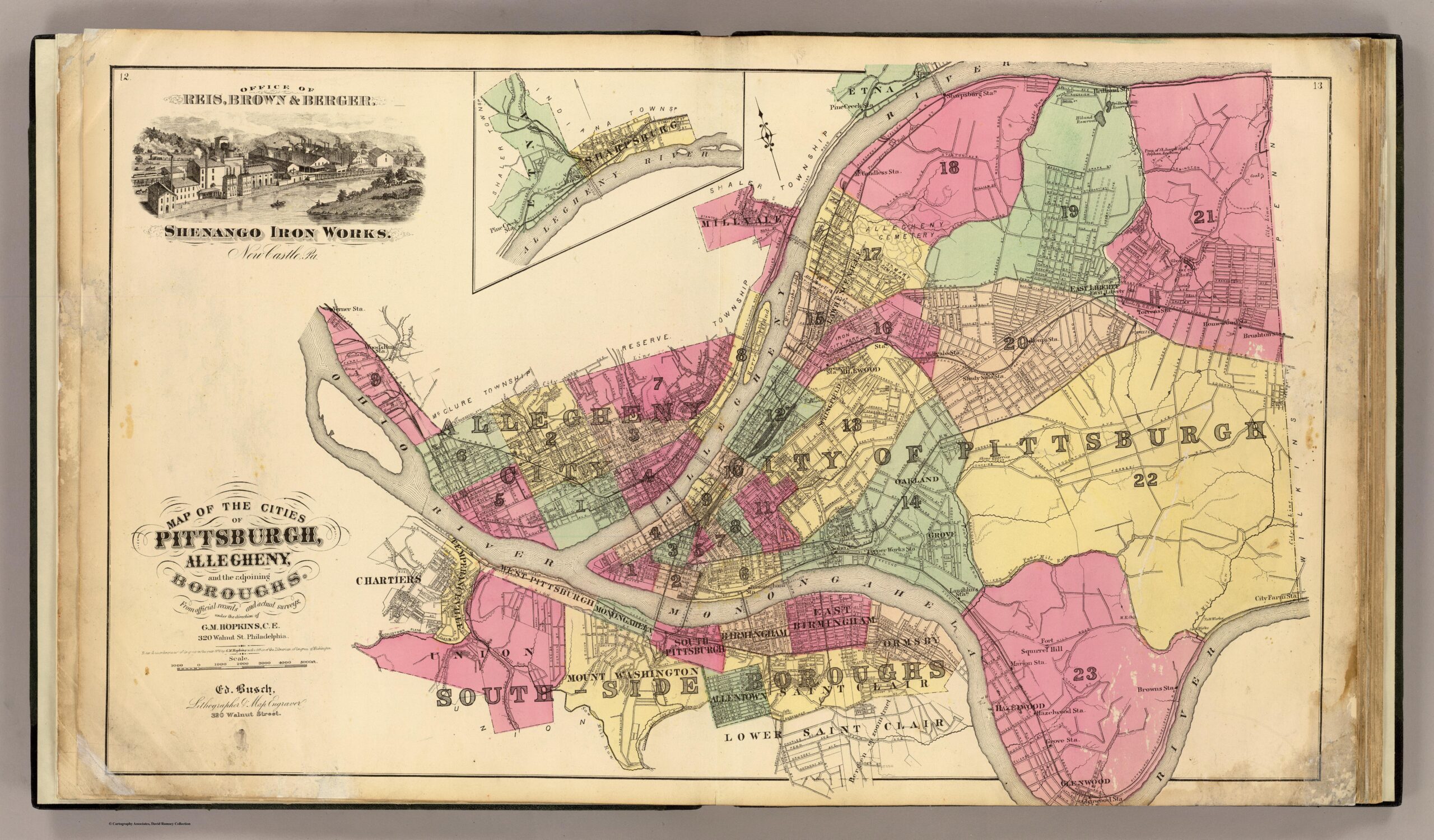
The Wards of Pittsburgh
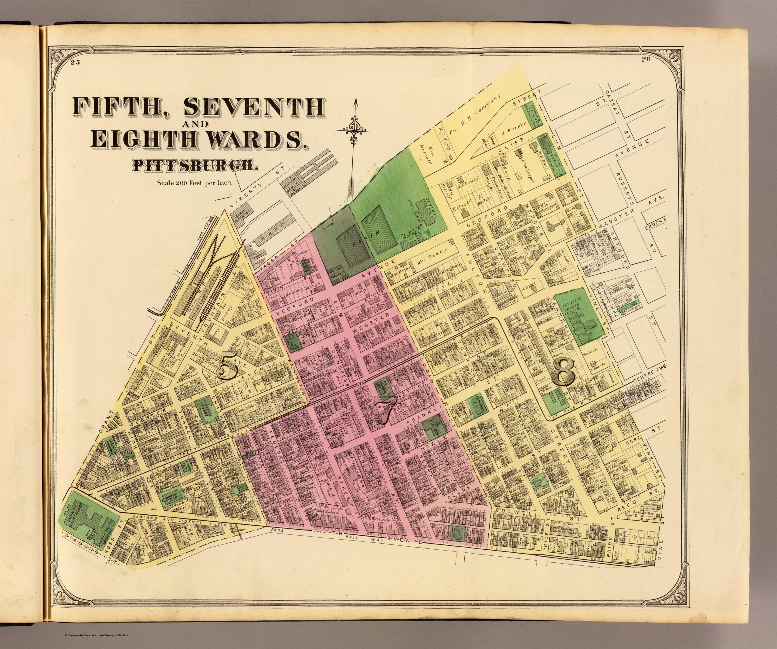
Pittsburgh 100 years after America